On 4th May 2014, Druk Asia Singapore Team travelled to Bhutan with four friends (Arlina, Raj, Tom & Xavier) to experience the famed Soi Yaksa Trek.
About Soi Yaksa a.k.a. Jomolhari Loop
Soi Yaksa Trek is named after the village of Soi Yaksa where we will camp on the 4th night after submitting the 4892m Bonte La pass. This is a deviation from the traditional Jomolhari Trek, which allows a trekker to explore the western reaches of the Jigme Dorji National Park. The traditional Jomolhari Trek takes trekkers from Paro to Thimphu, via Lingshi, crossing the Yelila to Shodu and Barshong and exiting the trek near Tango Gompa, 12km north to Thimphu. Soi Yaksa trek, also known as Jomolhari Loop, starts off from the army settlement at Sharna via Bonte La pass at 4892m to Soi Yaksa and return trekkers back to the same starting village after the 6th night.
The Jomolhari Trek is one of the most popular treks in Bhutan. Some 848 trekkers experienced this trek in 2013, slightly less than the number of trekkers taking the four nights Druk path trek. We estimate that the traditional Jomolhari & Soi Yaksa trek are equally popular. Visitors numbers on this trek have been steadily increasing. In 2011, only 745 attempted the Jomolhari Trek.
Treks in Bhutan are all camping treks. Tour operators like Druk Asia provide the tents, sleeping bags and most camping equipment and camping staff to accompany to the trekking group. On this trek, besides the trekking guide, we also have a 7-man staff. They comprise of a camp leader who’s also the chief cook, two assistant cooks, two camp helpers and two horse herders with 14 horses.
The camp staff work on setting up the camps, all meals and packing up every day. Woodfire has been banned in Bhutan, and all trekking groups need to carry their portable gas tanks for the purpose of cooking for the duration of the trek.
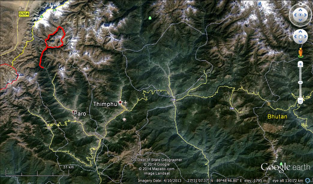
Soi Yaksa Trek KML file Mapped on Google Earth
Singapore to Bhutan and Acclimatisation for the trek
The group of travellers took Drukair’s KB501 from Singapore to Paro departing at 0630 AM. Arriving at Paro at about 1015 AM after an exhilarating touchdown thru the narrow valley of Paro, the group checked into Olathang Hotel, the oldest hotel in Paro built in 1974 to house overseas dignitaries attending the coronation of the 4th King of Bhutan, and proceed to check out Kyichu Lhakhang and the charming town of Paro.
Acclimatisation exercise is a hike up to the famed Tiger’s Nest Monastery the next day. The 4.2 km hike takes travellers from the elevation of 3000m above sea level to the viewpoint, standing at 3780m, overlooking the fabled temple from a height of 150m.
Tiger’s Nest Monastery, known as Taktsang Lhakhang locally, was first built in 1692 surrounding a cave which Guru Rimpoche, arriving on the back of a flying tigress, meditated for 3 years, 3 months, 3 days and 3 hours to subdue evil demons residing in the valley.
The hike up Taktsang is a good assessment of a trekkers physique and an acclimatisation exercise prior to the actual trek. This hike will allow the trekking guide to assessing a trekker’s pace, a trekker’s reaction to lower level of oxygen and allow the guide to building rapport with his trekkers prior to the trek.
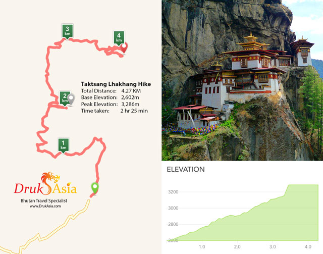
Tiger Nest - Taktsang Monastery Hike - Mapped by GPS
The road to Jomolhari Basecamp, Jangothang
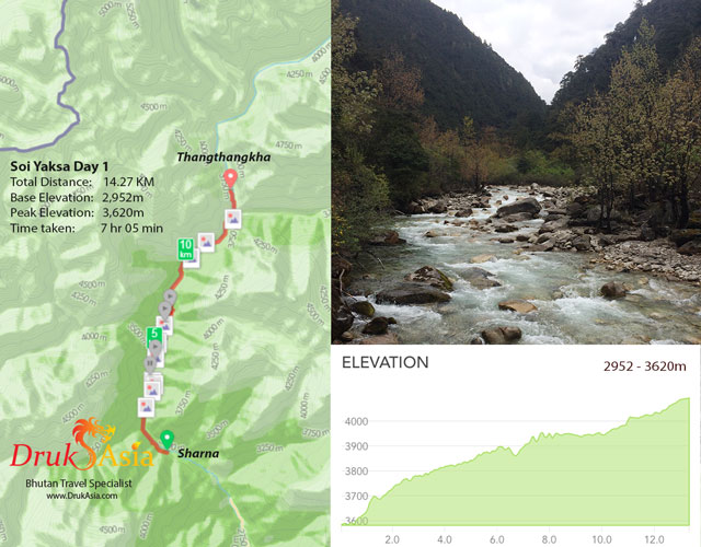
With the new farm road stretching all the way to the army encampment at Sharna and deep into the village since 2011, the trek officially starts from Sharna, cutting the trek duration by one day each way. In various guidebooks, this day is still listed as a 22km trek. Druk Asia’s team was using their smartphones to track their path on GPS and map the trail.
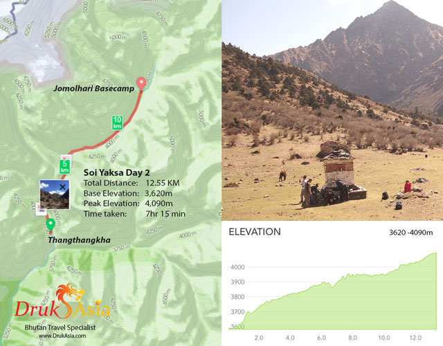
From Sharna, it’s now only a 14.72 KM trek along the Paro Chu to the campsite at Thangthangkha (3614m). The slope is gradual, ascending about 750m, the trek is paved with stones making it a much more trying effort. Thru out the day, the path zigged and zagged thru the temperate forest, crosses the river several times using semi-permanent bridges, Arriving at Thangthangkha camp site, a spacious are suitable for up to some 6 camping groups, at about 4pm, after 7 hours of trekking (this include a tea break and a lunch break)
Day 2 will bring our trekkers to Jomolhari basecamp. We were very near the Bhutan-Tibetan border and apparently there is a few fork path that can bring us to the border into Tibet. It’s thus important to follow your guide’s instruction and avoid straying into the Tibetan Plateau. An hour walk from camp, we will pass a military check post where all trekkers will have to be accounted for. After the camp, we will be leaving behind the tree line and start to trek in the alpine territory.
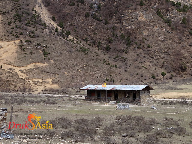
A 12.55 Km trek and ascending 400m, we will pass by a small town with Basic Healthcare Unit (BHU), a tiny school of 24 students for the region and an administrative centre to reach the Jomolhari basecamp. Speaking with the only two teachers in this remote school, it was told that they had to beg the parents of the children to send them to school. School is typically a 45min – 60 min walk from their home. Not far from the school is also visibly the only mobile signal relay station in this area. At the moment, only mobile voice and GPRS data signal are available mostly only good enough for local calls.
Marking the Basecamp is a mani wall, the ruin of Jangothang Dzong, beyond which lies Mt Jomolhari looming over the camp and seemingly closer to us than ever [click to see photosphere of campsite].
Click to see photosphere of campsite
Halt at Jangothang
Most trekkers will opt to take a day halt at Jangothang. Take a breather and enjoy the serenity offered by the magnificent mountains and a bit of exploration around the basecamp. This is especially useful to help acclimatize to the environment as the assault on Bonte La pass can be grilling.
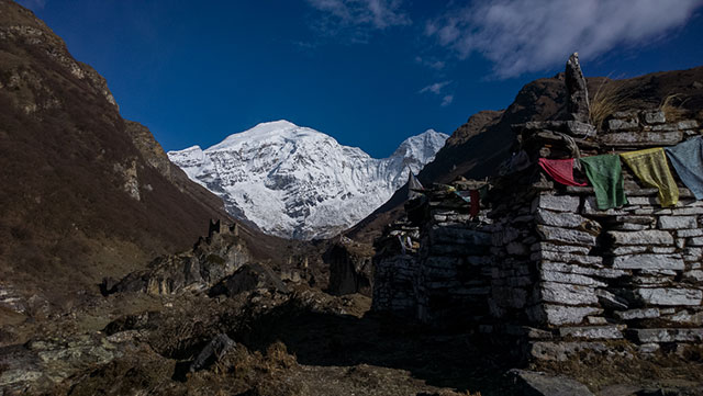
View of Mt Jomolhari from basecamp, marked by a mani wall and a ruined dzong..
Photo courtesy of Tom White.
Another option is also to move the campsite up to an intermediate stop just before Tshopho Lake. Should you do so, you will then traverse the 300m ascend in the afternoon and not have to do so early the next morning. Camping at Tshopho Lake can be chilling affair though as the valley is a wind tunnel itself. However, on hindsight, it might be a better option. Scaling the 300m steep ascend and later the Bonte La pass can be all too challenging in one afternoon especially if your team mate is not at their physical peak.
Bonte La Pass
The real Challenge - To Bonte La pass and beyond
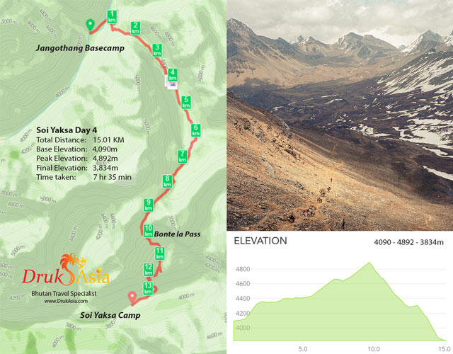
Day 4. The trek to Bonte La pass brings trekkers pass the twin glacial lakes of Tshopho Lakes. Legends say that a powerful spirit protects that still lake, and it's unwise to disturb its surface. The lake is frequented by beautiful ducks plucking trout off the surface of its water.
If you have started from Jangothang basecamp this morning, it will be a 15 km trek ascending almost 900m to Bontela at 4892m and followed by a 500m descend thru a rocky valley which opens up a beautiful meadow with grazing blue sheeps, followed by a near vertical 500m descend of animal trails to the village of Soi Yaksa where the next campsite lies.
The real climb starts right after a tea break in between both lakes. From here, it will be the hike of about 4.5km (500m ascent) over 2-3 hours to reach the pass. The landscape arid, the air crisp and thin, view majestic with her imposing cliffs is the setting for this both physically & mentally challenging assault. Surmounting the windy and snow covered pass is certainly satisfying and rewarding for the soul. Do remember to bring along a string of prayer flags to be strung across the highest point and allow the howling winds to bring your prayers to the four corners of the world.
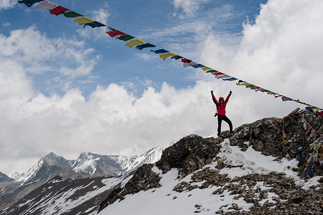
Xavier in ecstasy on top of the 4892m Bonte la pass.
Photo courtesy of Tom White.
Packed lunch will be served beyond the pass, overlooking a peaceful meadow grazed by Himalayan blue sheeps and potholed by the excavations of the Himalayan marmots. Crossing the meadow, we continue the descent to the campsite, trotting down a steep, narrow path towards the apple orchards of Soi Yaksa village. Camp will be on a beautiful grassy slope slightly after the village.
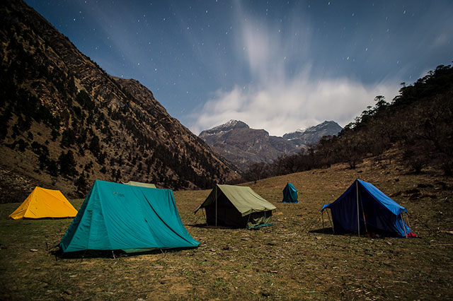
Our encampment at Soi Yaksa village on the fourth night.
Photo courtesy of Tom White.
To Thombu Shong or Not.
Our trek should take us to Thombu Shong crossing Takhung La pass (4,520m) over an 11km trail. However due the exhaustion of one of our team mate, we decided to continue downstream forgoing Takhung La pass. Perhaps on another occasion. The return leg after Soi Yaksa offers equalling spectacular visage thru the temperate forest and exiting the trek at Sharna.
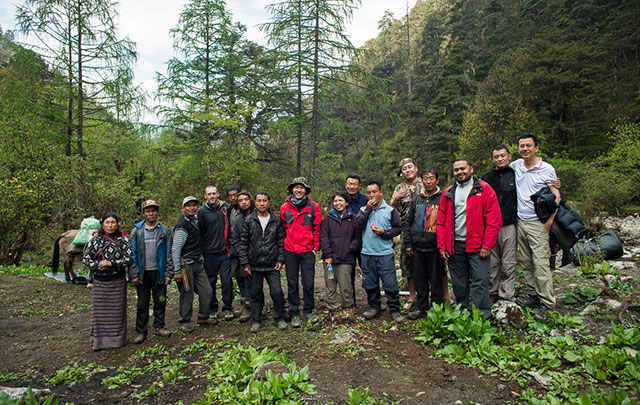
The team of 5 trekkers with our 7 camp staff, guides and a family whom shared our camp site.
Photo courtesy of Tom White.
