 Druk Asia
Preparing your journey…
22 Day Lunana Trek, Bhutan’s Half Snowman Trek
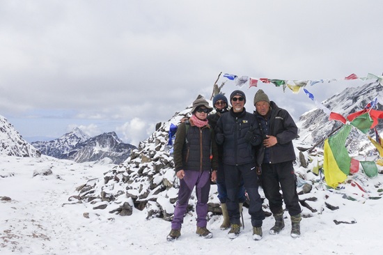
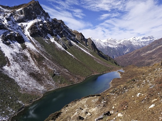
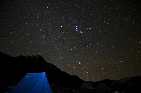
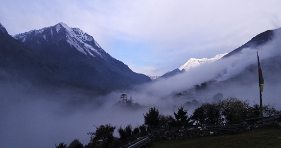
The Lunana Trek, often called the Half Snowman Trek, takes you through one of the most remote and demanding sections of Bhutan’s legendary Snowman route.
Beginning near Laya, the journey crosses deep river valleys, glacial landscapes and a succession of mountain passes above 5,000 metres before descending towards Sephu. Along the way, you will pass through isolated highland communities such as Woche, Lhedi, Chozo and Thanza, where life continues at a pace shaped by the mountains and seasons.
This is not simply a longer version of a regular Bhutan trek. The route demands excellent fitness, previous trekking experience and the mental resilience to spend many consecutive days in remote terrain. Accommodation during the trek is in fully supported tented camps, with a Bhutanese trekking crew, cook and pack animals carrying the main equipment.
Travellers who want an even longer expedition can compare this journey with the full Snowman Trek. You can also explore our complete collection of Bhutan trekking and hiking tours.
Lunana Trek (Half Snowman Trek) at a Glance
| Trek detail | Information |
| Duration | 22 days and 21 nights |
| Trekking days | Approximately 15 days |
| Approximate trekking distance | About 225 kilometres, depending on the trailhead and campsite locations |
| Starting point | Koina, reached by road from Punakha |
| Finishing point | Sephu |
| Highest point | Rinchen Zoe La, approximately 5,320 metres |
| Highest overnight camp | Jichu Dramo, approximately 5,060 metres |
| Difficulty | Extremely challenging |
| Trekking style | Fully supported camping expedition |
| Best period | Late September to October |
| Accommodation | Hotels in the main towns and tented camps during the trek |
| Suitable for | Experienced trekkers with excellent fitness |
Distances, walking times and elevations are approximate. Trail conditions, weather, landslides, river levels and the availability of pack animals can affect the daily route.

All our tours are fully customisable — the itineraries you see are simply a starting point. We'll work closely with you to tailor every detail.
22 Day Lunana Trek, Bhutan’s Half Snowman Trek Itinerary
1
Paro elevation: Approximately 2,200 metres
Thimphu elevation: Approximately 2,334 metres
Driving time: Approximately 1 to 1.5 hours
Accommodation: Hotel in Thimphu
Welcome to Bhutan. Your guide will meet you at Paro International Airport and accompany you on the drive to Thimphu, Bhutan’s capital.
The first day is deliberately kept flexible so you can recover from your flight and begin adjusting to the altitude. Depending on your arrival time, you may visit the National Memorial Chorten, where Bhutanese residents gather throughout the day to pray and walk around the sacred monument.
You may also visit the Folk Heritage Museum, the Royal Textile Academy or the Institute of Zorig Chusum, where students learn Bhutan’s traditional arts and crafts.
Enjoy your first Bhutanese dinner and meet your guide for a briefing about the journey ahead.
Overnight in Thimphu.
2
Punakha elevation: Approximately 1,242 metres
Driving time: Approximately 2.5 to 3 hours
Accommodation: Hotel in Punakha
Leave Thimphu and climb towards Dochula Pass at approximately 3,100 metres. The pass is known for its 108 memorial chortens and wide views of the eastern Himalayas when the weather is clear.
Continue into the warmer Punakha Valley and visit Punakha Dzong, one of Bhutan’s most impressive fortresses. The dzong stands where the Pho Chhu and Mo Chhu rivers meet and remains an important religious and administrative centre.
If time and energy allow, take the short uphill walk to Khamsum Yulley Namgyal Chorten. The walk passes through rice fields before climbing to the hilltop temple, giving your legs a useful warm up before the trek.
Overnight in Punakha.3
Starting elevation: Approximately 3,050 metres
Camp elevation: Approximately 3,840 metres
Walking distance: Approximately 19 kilometres
Walking time: Approximately 6 to 7 hours
Ascent: Approximately 790 metres
Accommodation: Tented camp
Begin early with a drive north through Gasa towards Koina, where the trek starts.
The trail climbs steadily towards Laya, passing through forested mountain terrain and opening to views of peaks such as Gangchhenta and Masagang when conditions are clear.
Arrive in Laya, one of Bhutan’s best known highland communities. Your campsite is normally established near the village.
The increase in sleeping elevation is considerable today. Walk slowly, drink regularly and tell your guide immediately if you experience a persistent headache, nausea, dizziness or unusual breathlessness.
Overnight at camp near Laya.4
Elevation: Approximately 3,840 metres
Accommodation: Tented camp
Spend a full day in Laya to rest and adjust to the altitude before entering the more remote section of the route.
Take a gentle walk through the village and learn about the traditions of the Layap people. Layap women are known for their distinctive black woollen dress and conical bamboo hats, which are often decorated with turquoise, silver ornaments and coloured beads.
Your guide may arrange a visit to a local home when the opportunity is available. Keep any walking light today, stay hydrated and give your body time to recover.
The trekking team will also use this day to check equipment and prepare supplies for the journey into Lunana.
Overnight at camp near Laya.5
Starting elevation: Approximately 3,840 metres
Camp elevation: Approximately 4,160 metres
Walking distance: Approximately 19 kilometres
Walking time: Approximately 6 to 8 hours
Ascent: Approximately 1,030 metres
Descent: Approximately 750 metres
Accommodation: Tented camp
Descend from Laya towards the junction of the Mo Chhu and Rhodo Chhu valleys. From the junction, the trail begins a sustained climb through conifer, maple and rhododendron forest.
As you gain elevation, the forest gradually gives way to more open mountain terrain. On a clear day, you may see the glacial valley below Tsenda Gang.
Cross a wooden bridge before reaching the campsite at Rhoduphu.
Overnight at Rhoduphu.6
Starting elevation: Approximately 4,160 metres
Camp elevation: Approximately 4,900 metres
Walking distance: Approximately 16 to 17 kilometres
Walking time: Approximately 7 to 8 hours
Highest point: Tsomo La, approximately 4,900 metres
Accommodation: Tented camp
Today brings your first major pass crossing.
Climb steadily through an open valley towards Tsomo La. In clear conditions, the pass offers distant views towards Jomolhari, Jichu Drakye, the Lunana mountains and the Tibetan border.
Continue across exposed highland terrain towards Narethang. The campsite sits among rocky slopes, small lakes and glacial features beneath Gangla Karchung.
This is one of the highest camps reached so far, so keep warm, eat well and report any signs of altitude illness to your guide.
Overnight at Narethang.7
Starting elevation: Approximately 4,900 metres
Camp elevation: Approximately 3,970 metres
Walking distance: Approximately 18 kilometres
Walking time: Approximately 7 to 8 hours
Highest point: Gangla Karchung La, approximately 5,120 metres
Ascent: Approximately 270 metres
Descent: Approximately 1,200 metres
Accommodation: Tented camp
Climb towards Gangla Karchung La, one of the most dramatic pass crossings on the trek.
From the pass, the landscape opens across glaciers, turquoise lakes and peaks including Tsenda Gang, Teri Gang and Jejekangphu Gang. Weather can change quickly at this elevation, so remain close to your guide and keep additional layers within easy reach.
Begin a long descent over moraine before entering thick rhododendron vegetation. Continue along the valley floor towards the campsite near the Tang Chhu.
Overnight at Tarina.8
Starting elevation: Approximately 3,970 metres
Camp elevation: Approximately 3,910 metres
Walking distance: Approximately 17 kilometres
Walking time: Approximately 6 to 7 hours
Accommodation: Tented camp
Follow the Tang Chhu through juniper woodland, passing waterfalls and sections of trail shaped by landslides and changing river conditions.
After a mixture of gentle walking and steeper climbs, reach Woche, the first permanent settlement encountered within Lunana.
The small village is surrounded by fields and broad mountain slopes. The sense of isolation becomes more apparent as you move farther from Laya and the nearest roads.
Overnight near Woche.9
Starting elevation: Approximately 3,910 metres
Camp elevation: Approximately 3,700 metres
Walking distance: Approximately 19 kilometres
Walking time: Approximately 7 to 8 hours
Highest point: Keche La, approximately 4,650 metres
Ascent: Approximately 300 metres
Descent: Approximately 450 metres
Accommodation: Tented camp
Climb above Woche and cross an area of glacial moraine before descending towards a wooden bridge.
The trail then climbs past an alpine lake to Keche La. Pause at the pass to take in the surrounding mountain views before beginning the descent into the Pho Chhu Valley.
Continue past waterfalls and the small settlement of Thaga before reaching Lhedi. The village has a school and basic health facilities serving the surrounding communities.
Overnight near Lhedi.10
Starting elevation: Approximately 3,700 metres
Camp elevation: Approximately 4,150 metres
Walking distance: Approximately 17 kilometres
Walking time: Approximately 7 to 8 hours
Ascent: Approximately 450 metres
Accommodation: Tented camp
Follow the Pho Chhu through a broad valley of juniper, farmland and scattered settlements.
As the valley opens, Table Mountain begins to dominate the skyline. Its broad summit and surrounding glaciers form one of the most memorable landscapes of the Lunana region.
Pass through Chozo, known for its old dzong, before continuing towards Thanza. The final section follows sandy and rocky paths across the valley floor.
Overnight near Thanza.11
Elevation: Approximately 4,150 metres
Accommodation: Tented camp
Thanza provides an important opportunity to rest before the final series of high passes.
Spend time exploring the village, recovering at camp or taking a short walk to a viewpoint above the valley. Longer walks towards the surrounding glacial landscape may be possible if weather, trail conditions and your physical condition allow.
Your trekking team will also coordinate the pack animals and supplies needed for the next stage. This can take time because animals used on the Laya section may need to be replaced by animals from Lunana.
Keep the day gentle. The most physically demanding section of the journey is still ahead.
Overnight near Thanza.12
Starting elevation: Approximately 4,150 metres
Camp elevation: Approximately 4,230 metres
Walking distance: Approximately 8 kilometres
Walking time: Approximately 3 to 4 hours
Ascent: Approximately 80 metres
Accommodation: Tented camp
Leave Thanza and climb above Thoencha to a viewpoint overlooking the settlements of Thanza and Chozo.
Continue through an open valley towards Danji, a grazing area used by yak herders. The shorter walking day allows more time to rest before crossing Jaze La.
Blue sheep are sometimes seen on the surrounding slopes, although wildlife sightings can never be guaranteed.
Overnight at Danji.13
Starting elevation: Approximately 4,230 metres
Camp elevation: Approximately 4,970 metres
Walking distance: Approximately 12 kilometres
Walking time: Approximately 5 to 6 hours
Highest point: Jaze La, approximately 5,150 metres
Ascent: Approximately 920 metres
Accommodation: Tented camp
Cross a stream and begin the long ascent towards Jaze La.
The pass offers wide views across a landscape of snow covered summits, rock, ice and open highland terrain. Descend from the pass through a series of glacial basins and mountain lakes.
Your campsite is beside Tshochena Lake at close to 5,000 metres. Temperatures can drop sharply after sunset, even when the day has been clear.
Overnight at Tshochena.14
Starting elevation: Approximately 4,970 metres
Camp elevation: Approximately 5,050 metres
Walking distance: Approximately 14 kilometres
Walking time: Approximately 4 to 5 hours
Highest point: Loju La, approximately 5,140 metres
Accommodation: Tented camp
Walk beside the lake before climbing to a high ridge. Descend towards another glacial lake and continue towards Loju La.
After crossing the pass, follow a series of ridges into a broad glacial valley. The surrounding landscape feels increasingly stark, with rocky slopes, streams, snowfields and distant peaks.
Reach the high camp at Jichu Dramo. At approximately 5,050 metres, this is expected to be the highest overnight campsite of the journey.
Overnight at Jichu Dramo.15
Starting elevation: Approximately 5,050 metres
Camp elevation: Approximately 4,600 metres
Walking distance: Approximately 18 kilometres
Walking time: Approximately 6 to 7 hours
Highest point: Rinchen Zoe La, approximately 5,320 metres
Accommodation: Tented camp
Today you cross Rinchen Zoe La, the highest pass of the Lunana Trek.
The climb leads through a dramatic landscape of glaciers, mountain lakes and snow covered ridges. From the pass, you may see Gangkar Puensum and the surrounding ranges when the sky is clear.
Take time to appreciate the achievement before beginning the long descent. Cross an open plateau and continue beside a moraine towards lower ground. Vegetation gradually returns as you approach the campsite at Chukarpo.
Overnight at Chukarpo.16
Starting elevation: Approximately 4,600 metres
Camp elevation: Approximately 4,300 metres
Walking distance: Approximately 18 kilometres
Walking time: Approximately 5 to 6 hours
Accommodation: Tented camp
Follow the river downstream towards the seasonal shelters used by yak herders.
Although much of the route loses elevation, a final climb is required to reach Thampe Tsho, a turquoise alpine lake surrounded by mountain slopes.
Lakes are considered sacred in Bhutan. Avoid swimming, fishing, throwing stones or washing directly in the water.
Overnight near Thampe Tsho.17
Starting elevation: Approximately 4,300 metres
Camp elevation: Approximately 3,610 metres
Walking distance: Approximately 14 kilometres
Walking time: Approximately 4 to 5 hours
Highest point: Thampe La, approximately 4,600 metres
Accommodation: Tented camp
Climb towards Thampe La, the final major pass of the expedition.
The surrounding slopes are known as habitat for blue sheep. After crossing the pass, descend towards Om Tsho and continue past another alpine lake.
The trail then drops steeply through forest towards Maurothang. Reaching the lower campsite is an important milestone after several nights at extreme elevation.
Overnight at Maurothang.18
Starting elevation: Approximately 3,610 metres
Road point elevation: Approximately 2,580 metres
Walking distance: Approximately 18 kilometres
Walking time: Approximately 5 to 6 hours
Descent: Approximately 1,000 metres
Accommodation: Hotel in Punakha
Follow the Nikka Chhu downstream through forest and gradually return to inhabited countryside.
Reach the road near Sephu, where your driver will be waiting. Say goodbye to the trekking crew before travelling to Punakha.
After many nights in the mountains, a hot shower, comfortable bed and warm hotel meal will feel especially welcome.
Overnight in Punakha.19
Elevation: Approximately 1,242 metres
Accommodation: Hotel in Punakha
Enjoy a full recovery day in Punakha.
There is no demanding programme today. Rest at the hotel, enjoy a gentle riverside walk or revisit a place that you were unable to see before the trek.
Your guide can also help arrange a traditional hot stone bath, subject to availability. The day gives your body time to recover before returning to Paro.
Overnight in Punakha.20
Paro elevation: Approximately 2,200 metres
Driving time: Approximately 4 to 5 hours, excluding stops
Accommodation: Hotel in Paro
Travel back across Dochula Pass and continue towards Paro.
Visit Kyichu Lhakhang, one of Bhutan’s oldest and most sacred temples. You may also visit the nearby Dilgo Khyentse Rinpoche Memorial House, subject to opening arrangements.
The remainder of the day can be kept free for rest, shopping or a quiet walk through Paro town.
Overnight in Paro.21
Starting elevation: Approximately 2,600 metres
Monastery elevation: Approximately 3,120 metres
Walking time: Approximately 4 to 5 hours
Accommodation: Hotel in Paro
Complete your Bhutan journey with a pilgrimage to Tiger’s Nest Monastery.
The trail climbs through pine forest towards the main viewpoint, where the monastery appears across the valley on a sheer cliff face. Continue down a flight of steps, cross the bridge beside the waterfall and climb into the sacred complex.
Tiger’s Nest is associated with Guru Rinpoche, who is believed to have meditated at the site during the eighth century. Take time to explore the temples before descending to the trailhead.
After completing the Lunana Trek, the Tiger’s Nest hike provides a meaningful final experience and an opportunity to reflect on the journey.
The evening is free for a farewell dinner or a traditional hot stone bath.
Overnight in Paro.22
Your guide and driver will accompany you to Paro International Airport for your departure.
We recommend keeping your camera accessible during the flight. Clear weather can reveal exceptional views of the Himalayan range shortly after take off.
Tashi Delek, and thank you for travelling with Druk Asia.
Route Map
Best Time to Complete the Lunana Trek
Late September through October offers the strongest chance of completing the Lunana route. The summer monsoon has normally begun to recede, visibility improves and the high passes may remain open before heavier winter snowfall arrives.
Conditions can still change quickly. Snow may fall at any time at higher elevations, and early winter weather can block a pass with little warning.
Selected spring departures may be possible after the winter snow has cleared, but the route must be assessed carefully. Departure dates should be planned around realistic trail conditions rather than general Bhutan sightseeing seasons.
The Lunana Trek should not be promoted as a trek that operates throughout the year.
Read our guides to the best time to visit Bhutan and the best trekking seasons in Bhutan before choosing your travel period.
Accommodation and Meals
You will stay in comfortable hotels while travelling through Thimphu, Punakha and Paro.
During the trek, accommodation is in tented camps. The trekking crew establishes the campsite, prepares meals and manages the main equipment. Sleeping tents, a dining tent, sleeping mats, sleeping bags and essential camp equipment are provided.
Meals during the trek are prepared by the camp cook. The menu is designed around ingredients that can be transported safely into remote areas. Inform Druk Asia in advance about allergies, vegetarian requirements or other dietary needs.
Facilities become basic once the trek begins. You should be comfortable with limited washing facilities, simple camp toilets and several days without access to electricity or mobile service.
Preparing for the Lunana Trek
Begin physical training at least three to six months before departure.
Your preparation should include:
- Long walks on consecutive days
- Regular hill or stair climbing
- Cardiovascular endurance training
- Leg and core strengthening
- Walking with the boots you intend to use in Bhutan
- Carrying a day pack during training
- Testing waterproof clothing in wet and windy conditions
- Spending time at altitude before the journey, when possible
Consult your doctor before booking if you have a heart condition, respiratory condition or concerns about travelling above 5,000 metres.
Your travel insurance must specifically cover trekking above 5,000 metres, emergency medical treatment and helicopter evacuation. Standard travel insurance policies may exclude activities above a stated elevation.
What to Pack
The weather can shift from warm sunshine to rain, sleet or snow within a few hours. Bring a flexible layering system rather than one heavy item.
Important personal equipment includes:
- Waterproof trekking boots that have already been worn in
- Waterproof jacket and trousers
- Warm insulated jacket
- Thermal base layers
- Fleece or warm mid layer
- Warm hat and sun hat
- Waterproof gloves and spare liner gloves
- Trekking poles
- Sunglasses with strong ultraviolet protection
- High protection sunscreen
- Head torch with spare batteries
- Personal medication and basic first aid supplies
- Reusable water bottle
- Water purification method recommended by your trekking team
- Power banks for essential devices
- Dry bags or waterproof liners
- High energy snacks you already know and enjoy
Druk Asia will provide a detailed equipment list before departure and confirm which camping items are included in your package.
What Makes the Lunana Trek Special?
Travel deep into the Bhutanese Himalayas
The Lunana region is separated from Bhutan’s main towns by high passes and difficult mountain terrain. Several communities along the route remain accessible mainly on foot, creating a sense of isolation that few other trekking routes can offer.
Meet the highland communities of Laya and Lunana
Your journey begins near Laya, home of the Layap people, before continuing into Lunana. Traditional dress, yak herding, subsistence farming and Buddhist customs remain part of daily life throughout these mountain communities.
Cross some of Bhutan’s highest trekking passes
The route crosses several passes close to or above 5,000 metres, including Tsomo La, Gangla Karchung La, Jaze La, Loju La and Rinchen Zoe La. On clear days, these crossings reveal glaciers, alpine lakes and some of Bhutan’s highest mountain ranges.
Experience a fully supported Himalayan expedition
Your trekking crew manages the camp, prepares meals and transports the main equipment using pack animals. You only need to carry your day pack with water, extra clothing, snacks and personal essentials.
Combine trekking with Bhutan’s cultural highlights
The journey also includes Thimphu, Punakha and Paro. Before and after the trek, you will visit important places such as Dochula Pass, Punakha Dzong and Tiger’s Nest Monastery.
Who Is the Lunana Trek Suitable For?
The Lunana Trek is recommended for experienced trekkers who can comfortably walk for six to eight hours on consecutive days.
You should be prepared for:
- Long ascents and steep descents
- Several nights above 4,500 metres
- Mountain passes above 5,000 metres
- Cold nights and rapidly changing weather
- Rocky, muddy and uneven trails
- Basic washing and camping facilities
- Limited communication and no quick road access during much of the trek
- Possible itinerary changes caused by weather or trail conditions
Previous experience on a high altitude trek is strongly recommended. Begin preparing several months before departure with regular hill walking, cardiovascular training, leg strengthening and long walks while carrying a day pack.
You can read our Bhutan trekking season guide when comparing the conditions across Bhutan’s different trekking routes.
Frequently Asked Questions
Is the Lunana Trek the same as the full Snowman Trek?
How difficult is the Lunana Trek?
Does the trek require technical climbing?
What happens if a mountain pass is blocked?
Will I experience altitude sickness?
Can beginners join this trek?
Are hotels available during the trek?
How is my luggage transported?
Do I need a visa for Bhutan?
How do I fly to Bhutan?





per person · SDF included
Plan This Journey →



Community Partners
Your journey contributes directly to local communities. Complete a feedback form after your tour and Druk Asia will donate to your chosen cause.
 Gyalyum Trust
 VAST Bhutan
 Museums of Bhutan
Let's Customise Your Dream Bhutan Adventure
Join over 22,940+ happy travellers who've trusted our Bhutan experts to craft journeys that are anything but ordinary.
- Visa guaranteed — or your money back
- Pick your perfect stay — charming farmstay or luxe hotel
- Design your day — change activities even while you're in Bhutan
- Add a vibrant festival — timing around Bhutanese celebrations is pure magic
- Hike more, or hike less — totally your pace
- Experience Bhutan like a local — hot stone bath, cooking session, astrology reading
